")
")
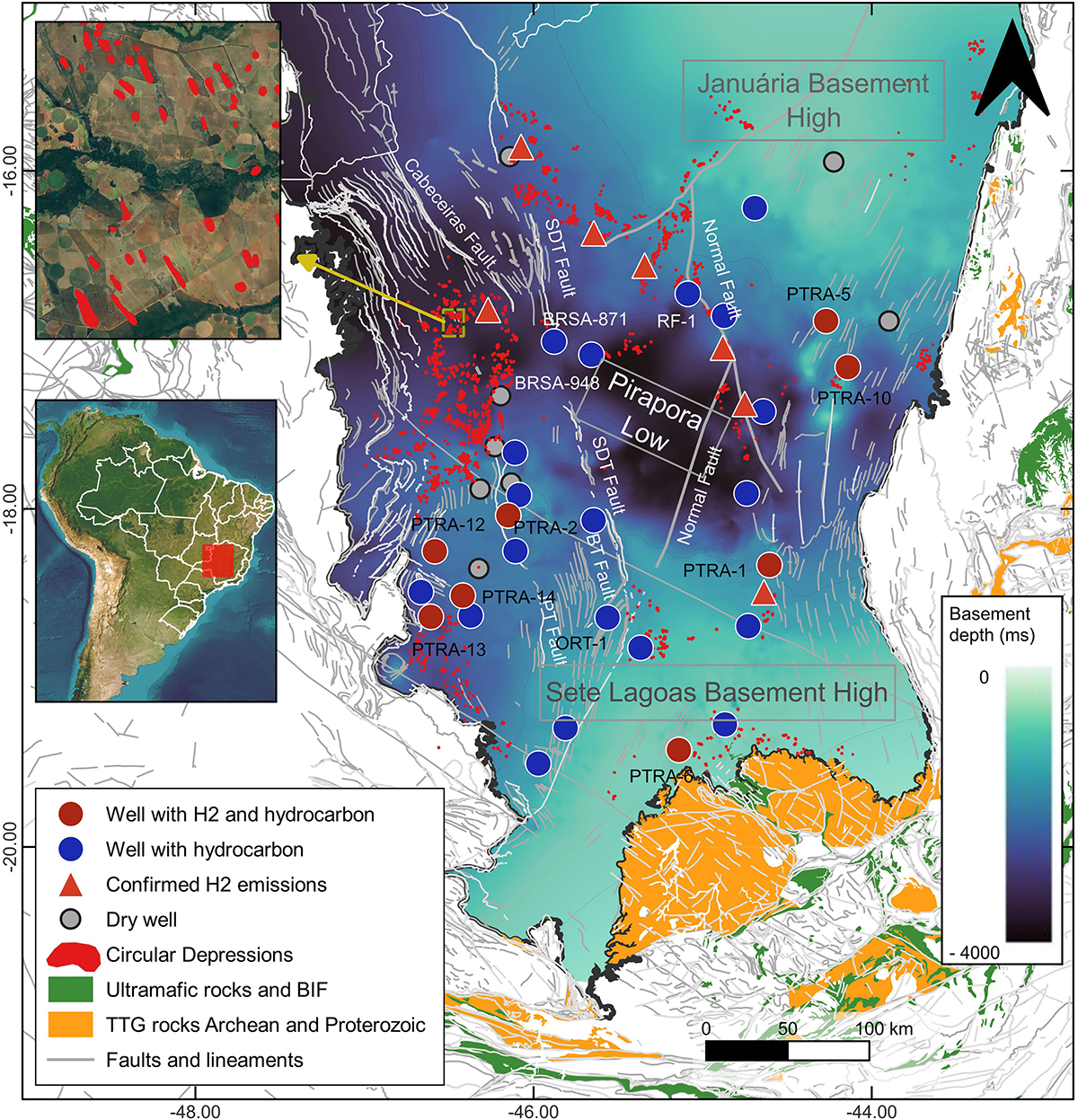
Fig. 4
Download original image
Map of the central and southern portion of SFB (Minas Gerais State, Brazil), representing the area of interest of this work. The basement structural map was based on time-migrated seismic reflection surveys (TWT). Wells with H2, SCDs and confirmed emissions of H2 by Moretti et al. (2021a) and Geymond et al. (2022) are plotted over the basement structural map. Faults and lineaments from Geological Map scale 1:1,000,000 of Geological Survey of Brazil. SDT Fault = São Domingos Thrust Fault, BT Fault = Borrachudo Thrust Fault, JPT Fault = João Pinheiro Thrust Fault after Reis and Alkmim (2015).
Les statistiques affichées correspondent au cumul d'une part des vues des résumés de l'article et d'autre part des vues et téléchargements de l'article plein-texte (PDF, Full-HTML, ePub... selon les formats disponibles) sur la platefome Vision4Press.
Les statistiques sont disponibles avec un délai de 48 à 96 heures et sont mises à jour quotidiennement en semaine.
Le chargement des statistiques peut être long.