")
")
Fig. 3
Download original image
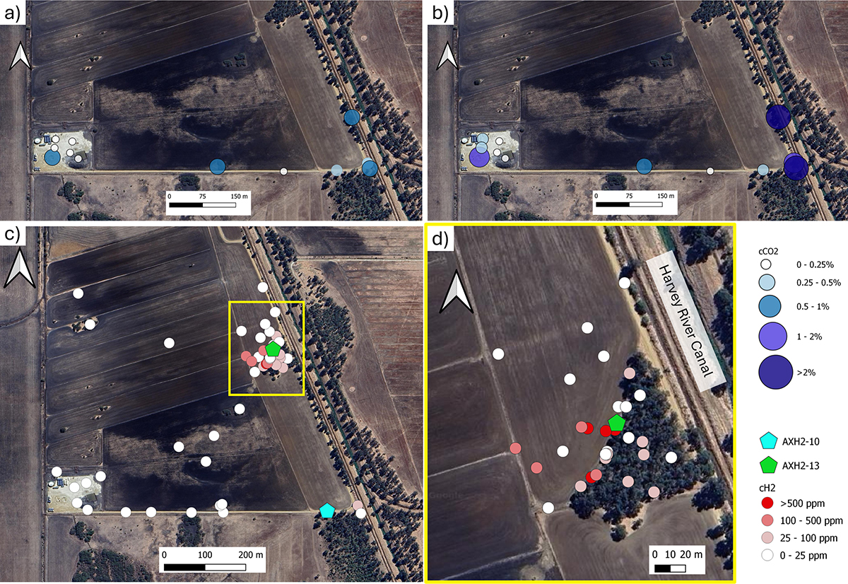
Point sampling near the DMP Harvey-2 well site. a) Initial cCO2 measured at each location on the 4th of May, 2022. b) Final CO2 measured at each location on the 4th of May, 2022. c) cH2 results for all point sampling and autonomous monitoring locations near DMP Harvey-2 during 2022, and d) Zoom in of area in yellow square in (c) close to the Harvey River canal, interpreted surface expression of the F10 fault, both modified after Maxar Technologies, Google Earth.
Current usage metrics show cumulative count of Article Views (full-text article views including HTML views, PDF and ePub downloads, according to the available data) and Abstracts Views on Vision4Press platform.
Data correspond to usage on the plateform after 2015. The current usage metrics is available 48-96 hours after online publication and is updated daily on week days.
Initial download of the metrics may take a while.