")
")
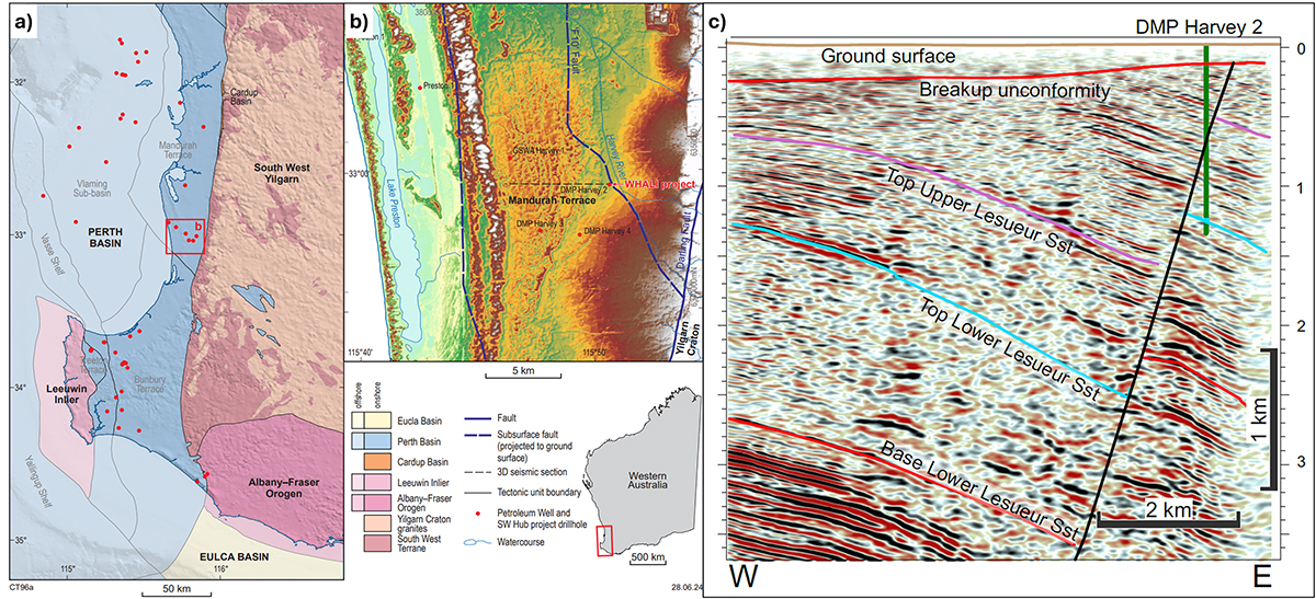
Fig. 1
Download original image
Geological context of the study area. a) Geological map of the southwest corner of Western Australia, highlighting the study area in the red square. b) DEM map of the study area (red square on a) showing tectonic elements and seismic line in c) West-east seismic section through the DMP Harvey-2 well site, which intersected a deep fault with ~1 km of normal displacement. The fault may show further displacement of the breakup unconformity; however, this is not resolvable on current seismic. The Lower Lesueur Sandstone is being investigated as a reservoir for CO2 sequestration.
Current usage metrics show cumulative count of Article Views (full-text article views including HTML views, PDF and ePub downloads, according to the available data) and Abstracts Views on Vision4Press platform.
Data correspond to usage on the plateform after 2015. The current usage metrics is available 48-96 hours after online publication and is updated daily on week days.
Initial download of the metrics may take a while.